Mima City
Mima City was founded March 1, 2005, with the merger of Mima region’s Wakimachi, Mima town, Anabuki town, and the village of Koyadaira.
| General Information | ||||||||||
It is located 40 km west of the prefecture’s capital, Tokushima City. It is rich with nature and culture. Running east-west through its center is the Yoshino River, joined by the Anabuki River in Anabuki. From the Asan mountain range in the north to Mt. Tsurugi in the south, the land is mostly mountainous, covered with about 80% woods or forests. Clean water and lush green hills make is a beautiful area. | 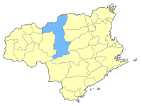 | |||||||||
| Population | ||||||||||
| ||||||||||
| As of Nobember 1, 2009 | ||||||||||
| Population | 33,391 | |||||||||
| Male | 15,970 | |||||||||
| Female | 17,421 | |||||||||
| Households | 12,903 | |||||||||
| Official Seal | ||||||||||
 | Green is for the many woods that stretch the city. Pink is for the sun, and blue is for the famed Yoshino River and the vast blue skies above. Together, the seal is a symbol of the harmony of Mima City’s people and culture, being close with nature. | |||||||||
| Climate | ||||||||||
Compare to Tokushima City in the eastern part of the prefecture, Mima City’s year-round temperature is lower. In the mountains, it tends to be even more extreme. | ||||||||||
| Geography | ||||||||||
Mima City is 367.38 k㎡ accounting for roughly 8.9% of Tokushima’s total area (4,145.69 k㎡). About 20.1% (73.74 k㎡), is inhabitable land. | ||||||||||
| 関連情報 | ||||||||||